Trailhead: Big Pine Creek - South Fork
Starting Elevation: 7800 feet
Peak: 14018 feet (+6200 feet)
July 1, 2017 update: Upper wall of Middle Pal is still covered in snow making the route inaccessible, unless you want to climb on snow at that angle. The regular "creek" crossing a mile into the approach is also hazardous but if you keep heading up ~40 feet, you can find other crossings that are waist deep. And finally, Finger Lake (high camp) is starting to melt out, there are a few snow-free camp areas but getting water takes a bit of clever maneuvering. Camping lower at at Brainard Lake is another option.
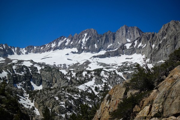 July 1, 2017 conditions on Middle Palisade, note the main gully is still filled with snow. Credit: shannonwarner |
||
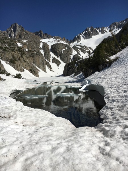 High camp at Finger Lake. Who wants to fetch water? Credit: shannonwarner |
||
When we got our permit that am, the rangers warned us that crossing over the South Fork creek 1 mile into the approach may be difficult this time of the year. We debated if we should switch out our permits for the North Fork but in the end decided to go with our original plan since all our research has been on Middle Pal.
Stopping to get our permit, forgetting my rock climbing shoes, and Patrick discovering his clip crampons not being compatible with his hiking boots put us 2 hours back due to a stop at Eastside Sports in Bishop. We didn't get to the Glacier Lodge trailhead until 11am. We dropped off our packs at the end of Glacier Lodge road (day parking only at the Big Pine Creek TH) and Patrick drove 1/2 mile back to the overnight parking and walked back.
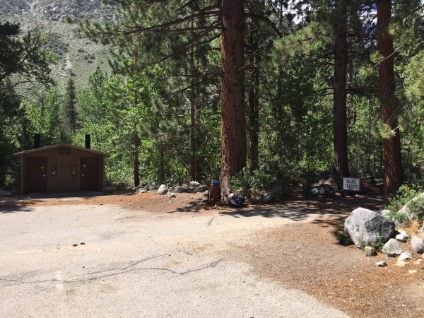 Start of our approach at Big Pine Creek Trailhead Credit: shannonwarner |
||
Hiking with an overnight pack under the hot sun made the approach less enjoyable and I vowed to myself to get an earlier start next time. A mile into the approach, crossing the South Fork of Big Pine Creek didn't really pose a problem for us in early July. The first option for crossing was thigh deep but the water was calm, 30 feet past the first crossing was a better option (ankle deep) but the moving water just means you had to be more careful crossing the shallow boulders. We took off our shoes and opted for the second option and had no issues crossing the creek.
After another mile of mellow uphill hiking, we started to encounter steeper switchbacks on the trail and caught a good view of our objective in the distant.
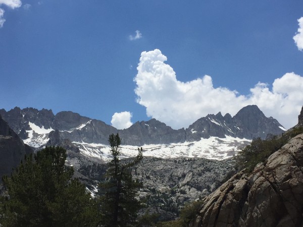 First sight of the glacier. Credit: shannonwarner |
||
The approach from Willow Lake to Brainerd Lake was infested with mosquitos and we moved as quick as we can. Make sure you have enough water to avoid having to fill up and getting eaten alive on this section of the trail. Up to Brainerd Lake, the trail was good and after skirting around the West side of Brainerd, the approach to Finger Lake was on cross country trails. After one last section of steep switchbacks, we were greeted with views of Finger Lake and the Middle Palisade glacier; this is one of the prettiest lakes I've seen.
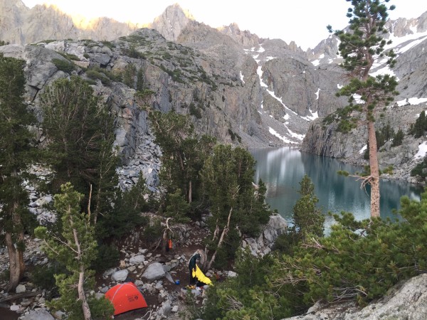 Our camp on the NE side of Finger lake Credit: shannonwarner |
||
After a quick meal, we tried to goto bed early that night and were ready to hit the trail again by 6am. After crossing the boulders at the outlet of Finger Lake on the north side, we headed up hill on the west side of Finger lake. Our target was the upper moraine rib that separated the Middle Palisade glacier.
If you didn't bring crampons, you can avoid the glacier by starting at the lower moraine rib all the way to the base of the Middle Pal. I always prefer traversing on snow over loose moraine so we opted to walk across the snow field instead and joined the upper section of moraine.
After switch backing to the top of the moraine, we had two route options. I read the standard route (South East Face) starts to the left of the red rock band but we picked the Red Rock alternate since it was easier to find.
There was one sketchy section that involves carefully crossing some scree below a small snowfield. A fall on this section could send you down a rock band and you can end up back on the glacier so we moved slow across this section.
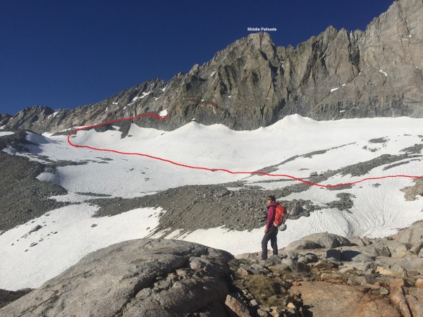 Our route is indicated in red (conditions in early July 2016). Note that you can avoid the snowfield by traversing from the lower moraine rib. Credit: shannonwarner |
||
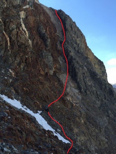 We choose to follow the red rock band. It's mainly class 3 and 4 and looks steeper in this photo than it really is when you're up and close to the rock. Credit: shannonwarner |
||
 Heading up the "Red Rock" gully Credit: shannonwarner |
||
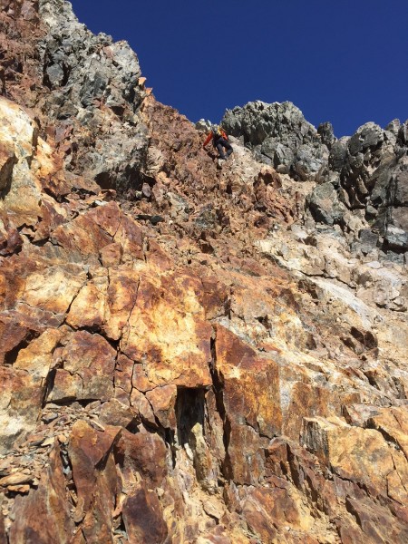
After the scramble to top of the red/white rock chute, you will arrive at the main chute where the East Face route converges with the red rock chute and you'll be on the climber's right side of the gendarme. At this point, just head up towards the top. The route is described as Class 3 but there were at least a handful of Class 4 and even some easy 5th class moves. You should be able to avoid the 5th class moves but we were just heading straight up and didn't mind the 5.2/5.3 moves.
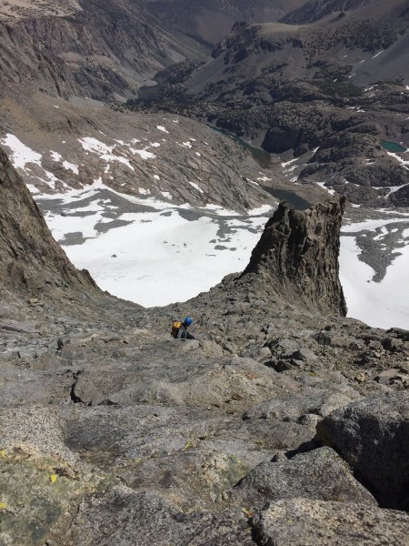 Heading up from the gendarme. Credit: shannonwarner |
||
The last 500 feet is a bit confusing as you'll see a few split chutes and a few summits. It's hard to tell which peak is the true summit and when in doubt, stay left at each split. When you are ~100 feet from the top, you'll see the summit towards the left.
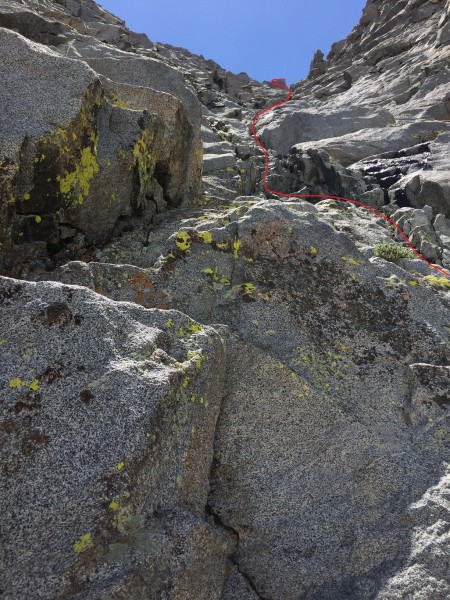 Approximate route to the summit. Credit: shannonwarner |
||
After skirting around the front side of the summit and a 5.4? move onto a small ledge, we arrived at the top.
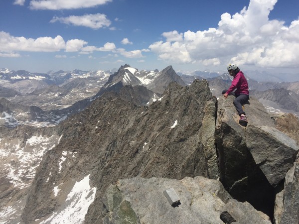 Looking north from the Middle Pal summit. Credit: shannonwarner |
||
After a 15 min break, we started on the descent by reversing our path. The descent should not be taken lightly as it takes most parties just as long (or longer) to reach the glacier compared to the uphill climb. It was easy to knock down loose rock onto your partner so we always kept 30 feet apart and avoided being directly above each other. We did bring a rope, harness, and climbing shoes but never pulled them out. If you're uneasy with down climbing 4th class terrain, it's a good idea to pack your climbing shoes. Helmets are highly recommended due to all the loose rock. From Finger lake, our trip to Middle Pal and back to camp was a full 12 hours.
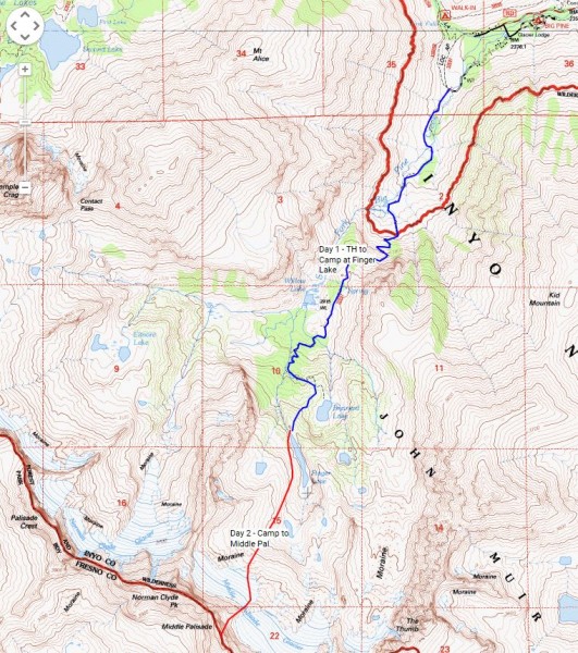 Our route to camp at Finger Lake (day 1) and to the summit of Middle Pal (Day 2). Credit: shannonwarner |
||