The Pacific Crest Trail has been an obsession for me for the last thirty years. In 1987 I made my first plans for a summer hike which ended when I broke my femur that spring. A fall job in Yosemite turned into a winter job there where I learned the joy of backcountry winter travel and rock climbing over the next few years
In 1990 after a summer job in Tetons I planned a winter trip of the PCT but could not pull it together financially. I managed to have some great skiing that spring with Lassen and Shasta being the highlights.
The fall of 2015 I found myself in the position to give it another go with a recent divorce and a pocket full of cash there seemed to be nothing that could stop me and I was finally off to give it a go.
I flew into San Diego on Oct 22nd 2015 with a one way ticket.
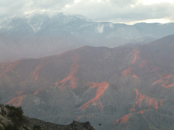
The big three (San Jacinto, Baldy and San Gorgonio) were glistening in the sun as the plane banked around to descend into San Diego. The drought was apparent from the air.
After a few mishaps in the city I managed to get a taxi ride to the border and start.
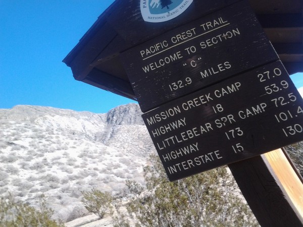
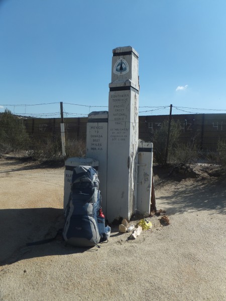 Southern Terminous Credit: Jay S |
||
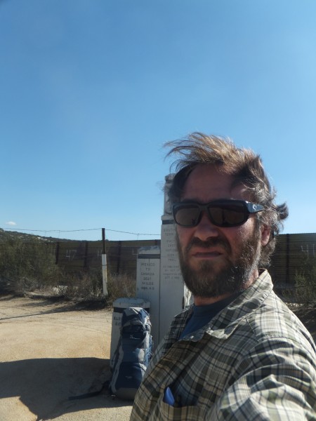 Credit: Jay S |
||
It was hot!
I stopped at the store in Campo and bought a Gatorade and some beer and hiked late into the night in sandals under a full moon. After midnight I bivied on the trail because of the lack of flat ground.
I was awaken much later by footsteps and sat up in the middle of the trail and scared the sh#t out of two illegal aliens who were sneaking in to the US. We spoke briefly and I wished them good luck
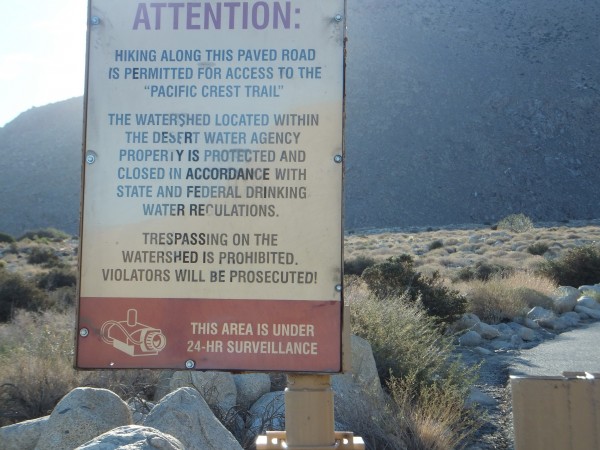
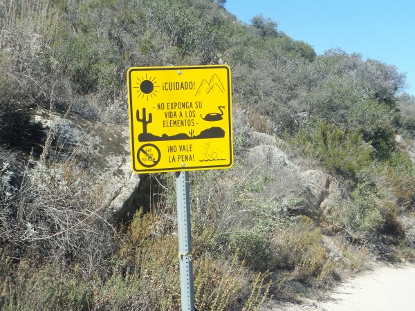 Warning sign Credit: Jay S |
||
I am up and hiking before dawn to beat the heat.
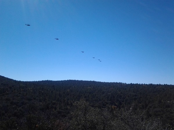
The border area is wild with a giant fence and border patrol everywhere and helicopters flying constantly.
It is quite a drop into Hauser canyon with no running water anywhere. I enter the first designated wilderness area and feel more at home. It is a hot climb out of the canyon.
 Credit: Jay S |
||
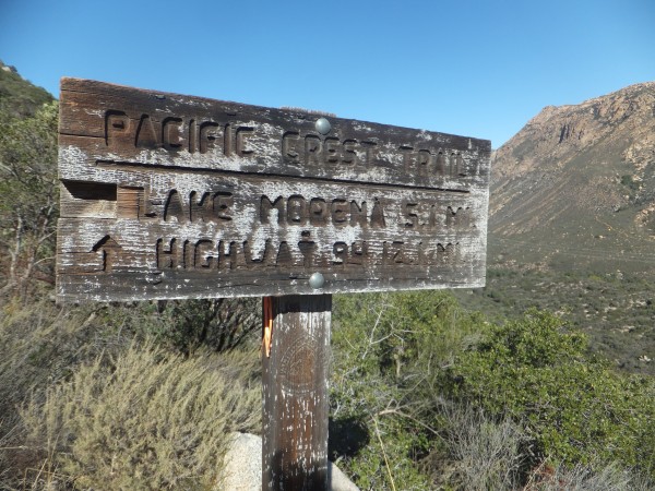
I roll into Lake Moreno and go to the store and buy a Gatorade and a beer and some beef jerky. The jerkey is good in CA (all natural). I buy another beer and go back to the campground. It is hot. I hate camping in campgrounds and after my second extra tall boy I start hiking in the late afternoon. It is starting to cool down but I carry four liters of water. I make it a few miles and have a fine bivy on a rock at mile 23. It is a nice perch and the moon is big.
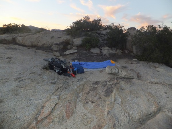 Fine Bivy Credit: Jay S |
||
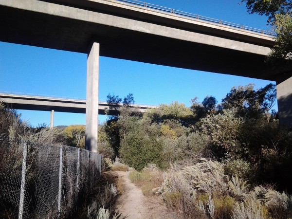
After a good nights sleep I am up at 4:30 and have coffee. It is a pleasant hike to Boulder Oaks campground where fill up my bottles and go underneath interstate 8. It is so different to see a busy highway again.
 Credit: Jay S |
||
It is a good climb up to Kitchen Creek. I drop my pack and venture down to see the falls. They are dry of course. Coming back up the hill I am surprised to see 2 dogs and 2 people the first real hikers I have seen. The trail traverses around to Kitchen Creek Road and here there is a water stash on one side of the road. The other side has a two liter bottle of Shasta cola boiling in the sun. How disgusting it sounds without ice.
It is a hot traverse around point 4737 and I stop and take a break under a shaded boulder and make some phone calls. When I started this trip I thought my parents health was fine and there would be no issues with them. I was mistaken in thinking that. My mother seems to be losing her mind and I find it wild as I was just visiting a week ago. This will change the trip for me in the upcoming months.
The traverse is easy into Fred Canyon and I take another break in some marvelous
oaks. It is to early to camp and I continue on and come to a sign warning about unexploded munitions from a helicopter crash at mile 32.6. It is no surprise that one crashed as they are flying through constantly very low.
 Credit: Jay S |
||
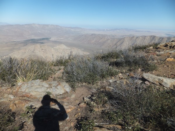
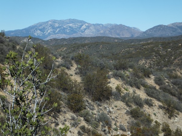
It is a nice climb above Long Canyon with great views to the south and I can see the pine forests around Mount Laguna.
In upper Long Canyon I find my first running water in 38 miles! I continue on planning to camp at Lower Morris Spring. Navigating with my phone I decide to take a shortcut and thrash down to a meadow below the trail. I realize I am in a lower meadow and thrash again to the right meadow. Good thing I am smarter than my GPS phone. Lower Morris spring has a slimy tank with a goldfish in it. The water does not look good. I go around the corner to look for better camping as I am a picky SOB. I find a nice sight with some rocks.
 Credit: Jay S |
||
It is nice to be in the pines!
I realize I will not be able to make the post office in Mount Laguna so I make a reservation at the Mount Laguna Store for a room. I buy a six pack of Sierra Nevada (my home for the upcoming winter) and take a bath. I feel guilty wasting so much water in an area where there is so little water around but at least it is running back into the ground.
I drink a few more beers and check out Sunrise Sports. After much deliberation I drop $800 on a new tent and trekking poles. In the morning I feel guilty for buying the tent but I am saving 3 pounds. I send my other tent further north to a friend along route in Markleeville CA and pick up supplies.
I hike back through Burnt Ranchero campground. It has closed for the season and is quiet. The oaks have turned gold for the fall and the trail is on top of a rim for a little while. I get on the web with my phone to check the water report, again it is so wild to have this technology in remote areas.
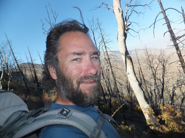
I decide to camp at Mount Laguna campground to have water. It is a nice campground with big oaks and pines but still cost $22. I set up my tent for the first time of the trip. It is 29 degrees in the morning and I am hiking by 6am and enter a big burn. The views are stupendous with views of San Jacinto that will take me days to reach.
After Kwaaymil Point the trail does a big descent that there has been significant work on. It seems like every few years Trail Crew comes in and whacks the vegetation back on both sides of the trail creating a super wide path. In other places the growth is really tight and you would not want to have your thermarest on the outside of your pack (more on that later)
 Credit: Jay S |
||
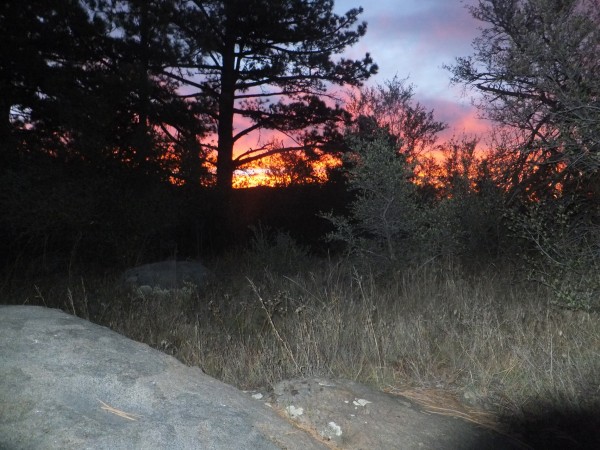
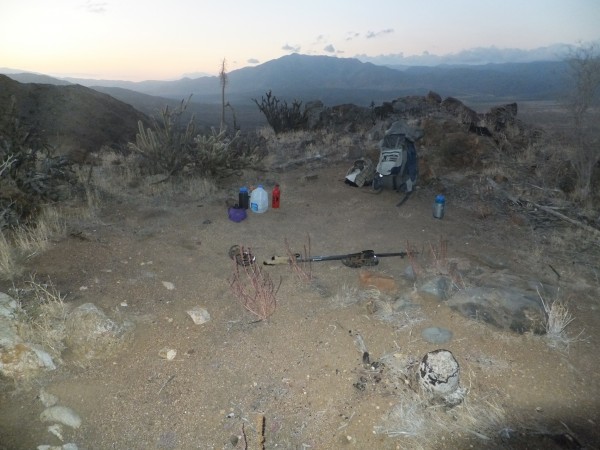
I arrive at Rodriquez Fire Tank at Dusk and have plenty of water. I treat two liters with my Steripen then it goes haywire. I boil water for dinner and have beef stew. This is my first twenty mile day. The coyotes are singing as the stars rotate around the sky
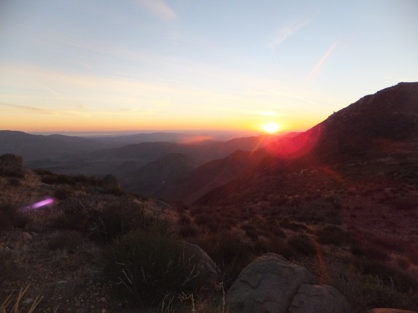 Sunset above Rodriguez Fire Tank Credit: Jay S |
||
In the morning I can not get my steripen to work again. I get a good cell signal and call steripen. They offer to send me a new one ahead to Cabazon (my 2nd next resupply point).
I make good time on the traverse around Granite Mtn
 Credit: Jay S |
||
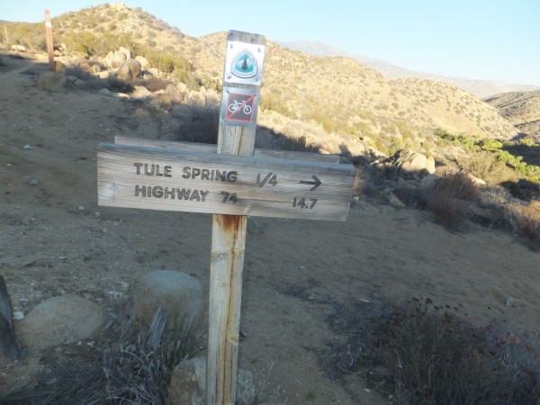
I reach scissors crossing and am overjoyed to pickup a gallon of water. The first cache is a mess of plastic jugs and old religious cards. I would implore everyone using caches to pick up all garbage.
It is another good climb into the San Felipe Hills. The terrain is wild here. There is drainage after drainage that the trail meanderers in and out of. The wind picks up in the afternoon. I run into several south bounders and walk well into dark to find a flat spot. The wind is howling all night and I just do another open bivy. It is an nice spot and a helicopter flies below me late in the night.
 San Felipe Hill Bivy Credit: Jay S |
||
Around mile 100 I get good cell service and talk to my father. Things are getting stranger with my mother and I am bothered and unsure about what is going on.
It is nice walking the rest of the way to Barrel Spring. It has rained here in the last couple of weeks so there is green grass coming in in places and it has cooled down.
Barrel spring is a nice shady spot with oaks. I drink the water without treating it and keep moving on to a nice camp in some oaks
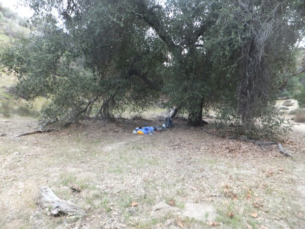 Oak Bivy Credit: Jay S |
||
 Credit: Jay S |
||
I arrive at the Warner Springs PO and pick up my supplies. The Church has much needed water.
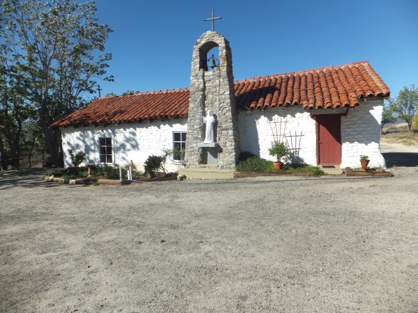 Credit: Jay S |
||
My pack is loaded with extra supplies and 5 liters of water and I take the back way north of Warner Springs back to the PCT proper.
The route is overgrown and I get a bunch of burrs in my socks because I am wearing shorts because of the heat.
The climb up Agua Caliente Creek is hot.
 Credit: Jay S |
||
Eventually I reach higher elevations with some shade. There is water in pools in the stream at random spots.
I top out on the climb and make a traverse around to Lost Valley spring
There is just a drip coming out of the spring. I wish I had a piece of tubing to get water out.
I have a nice bivy on the flat ground above the spring.
 Credit: Jay S |
||
The morning brings nice hiking through mixed forest and rocks. So many rocks
I drop down near the Chihuahua Valley Rd and see a cross. I wonder what the story is?
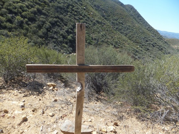 Credit: Jay S |
||
The water out of the tank tastes good. I am too thirsty to mess around boiling the water for treatment.
It is Oct 31st, the one year anniversary of my divorce. I have a reflective evening by eating a Mountain House Turkey Tetrazzini one of my ex wifes favorites freeze dried meals.
 Credit: Jay S |
||
The morning is clear (you have to love southern CA) and I continue walking.
 San Jacinto Credit: Jay S |
||
Aproaching highway 74 I meet Mike who is out on a dayhike. He offers me a place to stay and says we will meet me at Paradise Café a one mile walk down highway 74.
I have a couple of beers and a burger at the Paradise Café and Mike arrives.
We go back to his place and have more beer and good conversation. It turns out that he has hiked the trail multiple times and has some great stories. A bed and a shower are great! Thanks
Mike says the trail will always be there but it is hard for me to agree given the amount of time it has taken for me to make this trip happen.
WHAT FOLLOWS IS A FICTIONAILIZED ACCOUNT TO MAKE THE STORY BETTER!
Mike drops me off at the trail head early in the morning. I am facing a closure from a wildfire 2 years ago and decide to take a route that is recommended to me by Mike. I hate walking along busy highways that the official detour route makes.
There is supposed to be a big storm coming. I hike up the ridge and the wind gets stronger.
 Credit: Jay S |
||
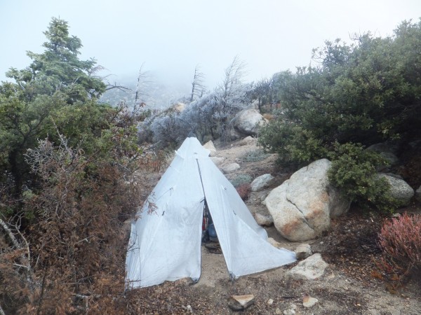
After Apache Peak the trail becomes pretty overgrown. The winds are now full bore and are moving me around with my heavy pack. Dusk nears and I am looking for a flat place to camp high on the ridge. My halfmile app on my phone tells me there are some flat spots coming up. I hike in the dark now by headlamp thrashing through wicked growths of puddledog bush. I eventually reach the flat areas and battle with the high winds to get my new tent up.
I tie it off to trees and rocks but I have to put rocks on the tent to hold it down. It starts to rain after dinner and howls all night.
 Credit: Jay S |
||
 Credit: Jay S |
||
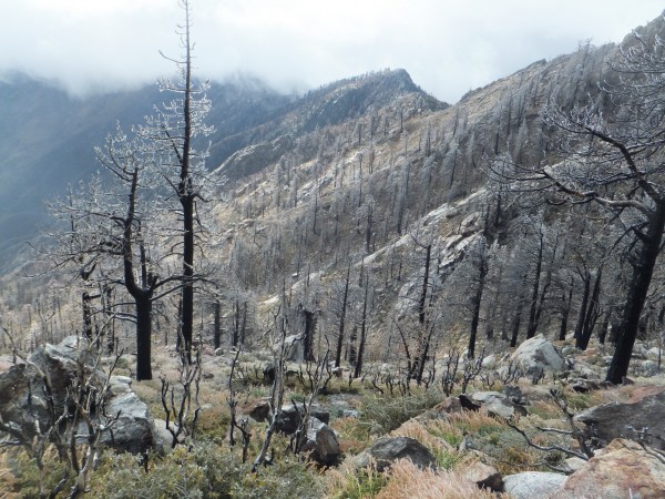
In the morning everything is covered with a glaze of ice. The rocks holding my tent down have poked holes in my new $600 tent. The faint path is slick in places and the prospect of getting injured in a closed area has no appeal to me. In places the trail is good and in others it is mostly gone. I pass Red Tahquitz and exit the closure. There is now more snow on the ground with the higher elevation.
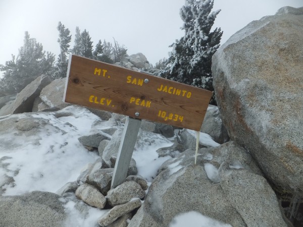
I decide to take a detour and go over to the summit of San Jacinto. I reach the junction where the tram trail comes in and see a few people. It is still a little treacherous on the icy trail.
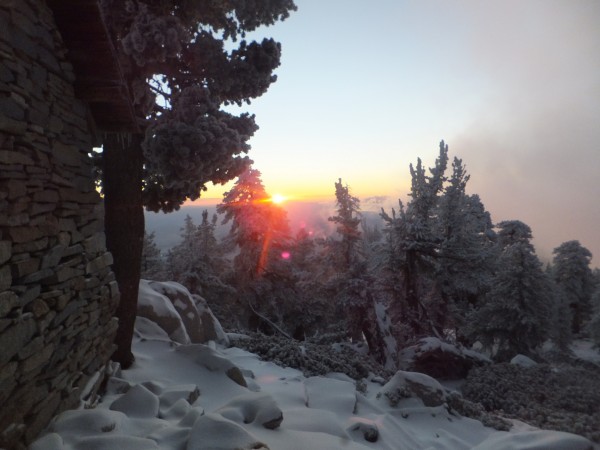
I reach the summit before dark and had planned on a bivy but find the emergency shelter.
 Credit: Jay S |
||
 Credit: Jay S |
||
 Credit: Jay S |
||
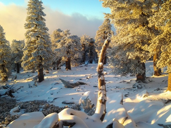
The trail is still slick with a glaze of ice under the fresh snow and I am glad to have my expensive carbon fiber trekking poles. It is an 8,000 foot drop to interstate 10.
 Credit: Jay S |
||
Darkness arrives and I see eyes in the dark from small critters and continue walking down to the Snow Canyon spigot.
I decide to bivy nearby and am on candid camera.
 Credit: Jay S |
||
I am feeling torn as my father wants me to come back to Kansas to help him with my mother but I hate to give up on my trip only two weeks in.
Dirt blows in my eyes and to clear them I shed a few tears by looking across at San Gorgonio, a mountain that I had hiked years ago with my dog Grubber who I put down last spring.
Grubber was such a good dog and had been on many of my adventures over the last 15 years.
The noise of interstate 10 becomes louder as I get closer.
The PCT has a tunnel underneath that I go through.
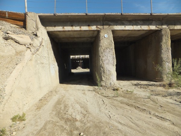 Credit: Jay S |
||
My resupply is at Ziggy and the Bears near Cabazon. I call them so they expect me this late in the season. They have a nice complex set up for hikers and I am the 1411 person to come through this year. They inform me about another trail closure and say I should take a bus around. Not happening.
I am all packed up with supplies and a new steripen and start off. I have good cell coverage on a hill above and call my father. He is beside himself and really wants me to come home to help him with my mother.
Dammit!
After more phone calls I realize I have a cousin in Palm Springs I have not seen in years. She used to live on the backside of Alpine Meadows ski area (more on this later) and I would stay with her and poach the ski area. She answers here phone and is surprised to hear from me. She agrees to pick me up at interstate 10. I walk the mile back down to the interstate with a heavy heart not wanting to give the trip up.
I find a round trip ticket out of Palm Springs the next morning for $500 and leave all of my gear at my cousins.
Palm Springs has a great airport. I have a beer before the departure and try to relax.
Kansas
I spend the next two and a half weeks in Kansas dealing with craziness.
There is something obviously wrong with my mother and it is impossible to get her to see the doctor. It was the main goal in coming back here.
Dementia and or Alzheimers is what the Doctor thinks but without a visit there is no official diagnosis.
Eventually it is time for my return to the PCT with a flight out of Wichita Kansas.
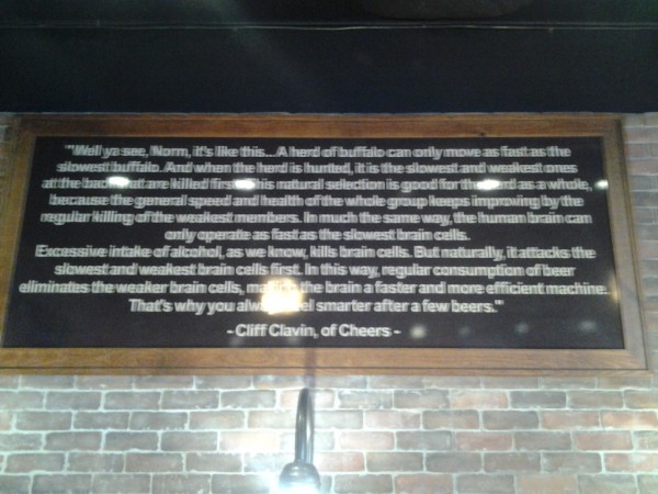
My flight is delayed so I have a beer to kill some time and have a laugh at a quote from Cheers hanging in the airport bar.
 Credit: Jay S |
||
My next flight out of Denver is a three hour wait so against my better judgement I continue drinking beer.
I am ready to get on my flight to Palm Springs when I am approached by two policemen. They inform me that I will not be getting on this flight. After much discussion/argument they have their way. I am forced into a taxicab that will take me to a motel and I will catch another flight in the morning.
Halfway to Denver I change my mind and have the taxi driver take me back to the airport. He doesnt think it is a good idea but I am the one paying. I manage to get back through security by muttering that I accidently got on the other side of security. I talk to no one and make the next flight to Palm Springs. So much for increased safety.
November 24 2015
I get dropped off north of interstate 10 where I stopped roughly 3 weeks before by my aunt and cousin.
 Credit: Jay S |
||