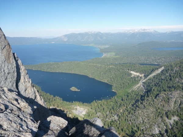
 View from Emerald Point Credit: clippinalong |
||
If it werent for a certain plant, I'm sure thered be a plenty of trip reports spreading the word about the granite on Emerald Point. I'm guessing that what usually happens is that a crack-happy pair of climbers gets to the summit and are in awe of the rock quality, lack of crowds, and spectacular views. But by the time they have bush-wacked through 2 hours worth of Manzanita on the descent-- and in the process torn through clothes, lost shoes to aggressive bushes, and ripped their skin to shreds-- they are over the idea of a trip report and pretty happy to let the day slide into the recesses of their climbing memory.
It happened to me! But as the Manzanita scratches heal, I still find myself thinking about what a (mostly) great outing it was, so here goes....
The previous weekend, Stephen and I had climbed separately in Eagle Creek Canyon, I at Eagle Lake Cliff and Stephen on Eagle Lake Buttress. We both eyed Emerald Point, and we set out on July 4th to explore the feature via a route called Section 20. We were also looking for All American Finger Crack, for holidays sake.
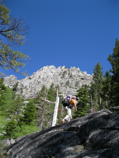
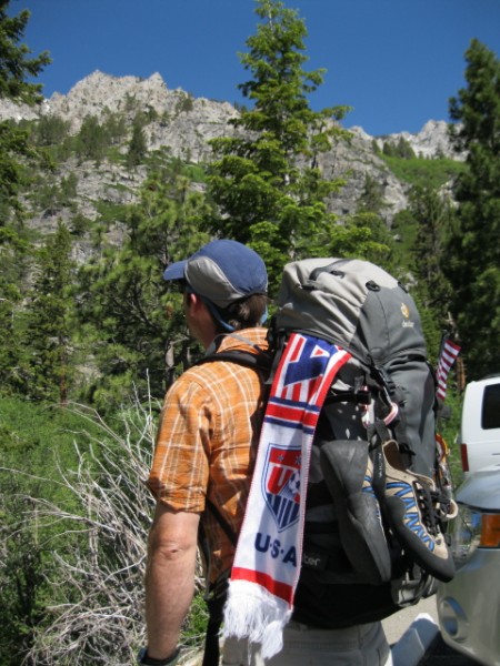 On the approach. Credit: clippinalong |
||
 Credit: clippinalong |
||
We took a mellow approach to the morning and cooked a full egg and toast breakfast, had coffee, and set out from the trailhead around 10 a.m. after hiding some beers in the river for later. We hiked passed climbers at 90-Foot-Wall and continued along Eagle Creek until we saw a boulder on the other side of the creek that seemed to be at the bottom of a shallow ravine. At this point, following the Carville guide book, we traversed up and left through some benign Manzanita and then came upon several very large boulders that signaled the start of the talus field we would follow upwards.
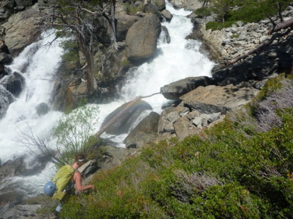 so much water (and foreshadowing of manzanita to come...) Credit: clippinalong |
||
 Stephen below Emerald Point Credit: clippinalong |
||
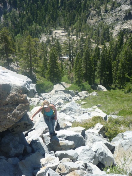 The talus field Credit: clippinalong |
||
We made our way to the top of the talus field. Though we sensed we should be going up and right, going right seemed lead us downhill. We finally figured out that we needed to go further up and left before heading right onto a terrace above the one where we had just been. From the higher terrace, we kept heading right, and then upwards alongside a buttress, and then finally back left again onto another terrace.
 time to climb yet?? Credit: clippinalong |
||
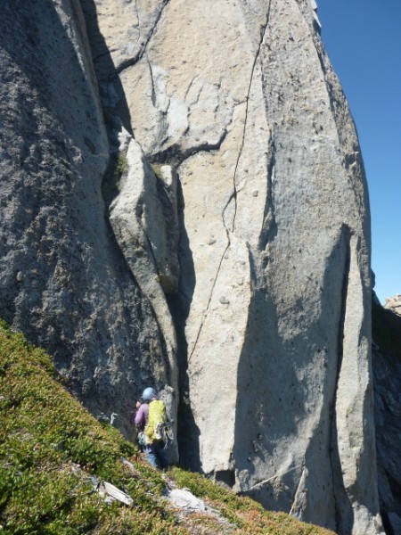
We weren't exactly sure where we were going, but no matter-- we met no huge resistance or exposed scrambling. We tried to stay on the south-facing part of the feature. We finally got to a spot where we were overlooking what might have been the start of the route--a chimney-like feature that was climable, with an arête with knobs out to the side. Seemed to match the topo and what we had read in a few other descriptions. In any case, we were ready to start climbing! We downclimbed from our perch and racked up.
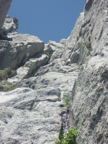 we think this was the start so we started here Credit: clippinalong |
||
Just before starting, we did a quick search for All American Finger Crack to the right and left of where we were, but nothing really stuck out. We thought maybe we had missed it on a lower terrace in our round-about-approach. We saw another cool-looking pitch to the lefta 4-5 crack with a small roof about 40 feet up.
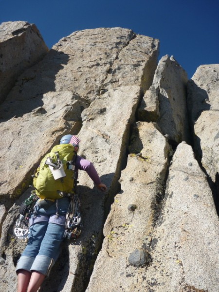
 Stephen ready to go Credit: clippinalong |
||
We went back to our chimney and started simul-climbing. After about 100 feet, the chimney opened up into a gully where we found an exposed face with a thin crack and good knobs. We could have scrambled to the left, though, and avoided this section. After that, we found an intimidating chimney to the right, which we passed up in favor of some interesting flakes and blocks to the left. We found ourselves on a platform, and from here we could see a big dead tree up to the right. We thought that maybe the tree corresponded to the tree on the topo, but at this point, trying to match the terrain to the topo was mostly for fun. I found it refreshing to have to think about where I was going and the best/safest way to ascend the rock, rather than rely on topos as I usually do.
We exchanged gear, and I took over the lead. First move off the ledge was up into a wide crack and then out around a bulge to the left on rotten rock with poor pro. After some grunting and swearing, I was up it, but not without showering Stephen with grit. From there the climbing eased dramatically until I was bi-ped again. This was the beginning of a traverse up and left, which took us around left of a rock formation with good looking cracks and through a notch into a grassy gully, which I think might be one of the Emerald Chutes in the winter. We stopped for a sandwich and evaluated our progress. From our vantage point it looked like the summit was still 6-700 feet above us. After eating, we kept walking up and left on sandy slopes. We did see an amazing looking finger crack with cool knobs, which I wondered for a second if it was All American Finger Crack. But that would have meant we were waaaay off route...not impossible.
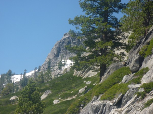
 yes, i want to climb you Credit: clippinalong |
||
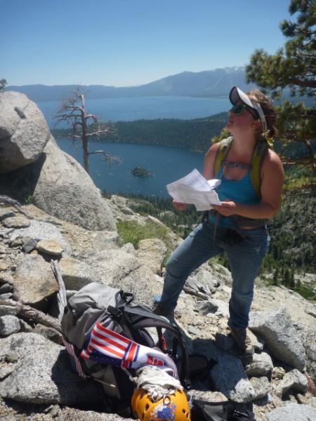
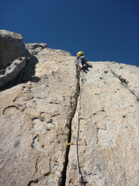
We started simul-climbing again at a gnarled pine tree and covered some fun low-angle terrain until coming to the base of a beautiful hand crack. I led up and over this, and then onto another platform, and then up a very short finger crack to another platform, which produced another beautiful moderate splitter handcrack! Wahoo! The views were also stunning. To the East we could Lake Tahoe, Glacier Lake, and Fallen Leaf Lake. To the West, we saw snowy peaks and rugged terrain of Desolation Wilderness.
 Credit: clippinalong |
||
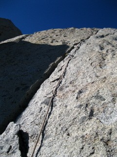 Stephen led this lovely crack Credit: clippinalong |
||
Stephen led the last hand crack and descended into what we thought was the summit notch on the other side. From there we headed west, and the adventure continued.
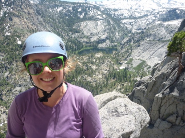
 Stephen with Desolation Wilderness in the background Credit: clippinalong |
||
I was drooling at all the good rock and fun-looking crack pitches, and looking at the suns angle, I figured I better pick one to do fast if we were gonna make it back before dark. I found a finger crack and figured we could go up and over and into the next notch. Well, there was no notch. I found myself riding a pinnacle about five feet above my last piece of pro. Fortunately, there was a horn on the right, which I hung a sling and biner on. Stephen kindly lowered me, and I cleaned my gear. I felt guilty that Stephen didnt get a chance to climb it! And lucky that I was able to get down with little cost.
 lesson learned: what goes up...must get down somehow Credit: clippinalong |
||
The sun was definitely going down, and we decided we better head down as well. We started west over 3rd and 4th class terrain and then headed back south through a notch towards the top of the original talus field. Only as we came through the notch, we could see that thick Manzanita stood between us and where we had started. Two hours of ridiculousness ensued. We kept surfing downwards, which made our path even longer than necessary. The Manzanita was over our heads at times. At one point, we had to cross a ravine where there were willow trees interspersed with the Manzanita. At another point, I was hanging off a steep slope by Manzanita branches. Not pretty. I laughed. I cried. I imagined if I were a botanist in a canvas suit with plenty of water and a full day ahead of me and no climbing gear in my pack, I might actually think it was fun to walk on tree tops and tunnel through their branches. But it was getting dark. And we were tired and out of water. And, oh yeah, I forgot to mention that I had left my headlamp in the car.
 Manzanita (cue horror movie sounds) Credit: clippinalong |
||
We finally made it to the boulders of the base of the talus field just as it was getting dark. From there, we ambled a little bit to find our original trail and were stoked to hit 90-Foot-Wall. Then a cool surprise: we rounded the corner to a vista point just in time to catch the fireworks show over Lake Tahoe.
We watched them in a state of delirium for a few minutes before heading down the trail to get water. After drinking about a liter each, we dug our beers out of the river (up several inches from morning!) and headed back to the car.
The traffic was terrible getting out of South Lake Tahoe post-fireworks, and it was tough to find a meal so we pulled the 12:30-a.m.-In-N-Out-in-Placerville move before driving back to the Bay.
Never a dull moment, but I wouldn't have it any other way.
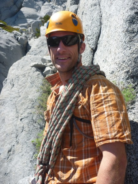
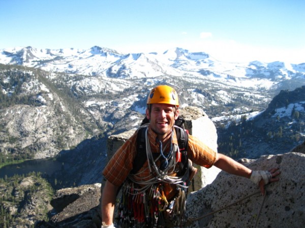
 me with Eagle Lake and Eagle Lake Cliff in the background Credit: clippinalong |
||